
Existed: 1937 – present Length 46.43 km | Constructed 1937 | |
 | ||
Counties | ||
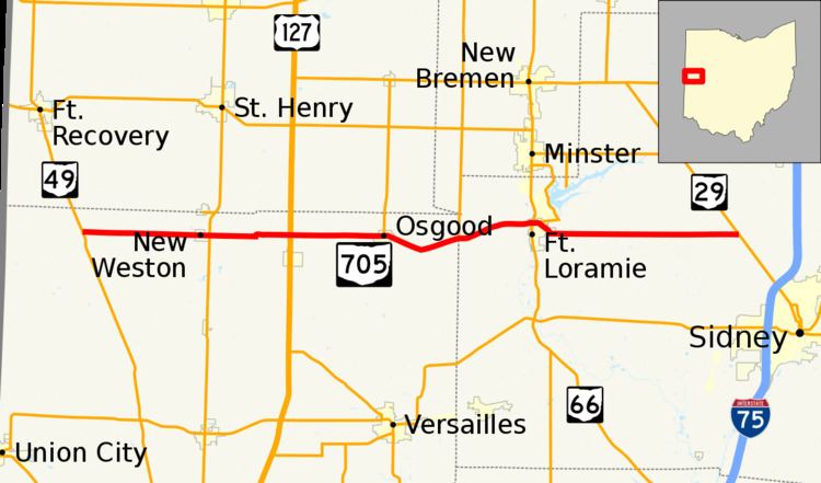
State Route 705 (SR 705) is a state highway in western Ohio, a U.S. state. The highway's western terminus is in rural northwestern Darke County at SR 49 approximately 5.25 miles (8.45 km) southeast of Fort Recovery, and just a mile south of the Darke-Mercer County Line. Its eastern terminus is at SR 29 nearly 2.75 miles (4.43 km) northwest of Sidney.
Contents
Map of OH-705, Ohio, USA
Established in the late 1930s, SR 705 connects the northern half of Darke County to the city of Sidney. The highway goes through rural areas in Darke County, passing through the villages of New Weston and Osgood heading east. The road follows very close to the Mercer County Line throughout Darke County. In Shelby County, Fort Loramie is the only village along the road.
Route description
Along its path, SR 705 travels through parts of the counties of Darke and Shelby. There are no stretches of this state route that are inclusive within the National Highway System.
History
SR 705 was designated in 1937. The route has not experienced any major changes to its alignment since its inception.