
Existed: 1937 – present Length 24.01 km | Constructed 1937 | |
 | ||
Counties | ||
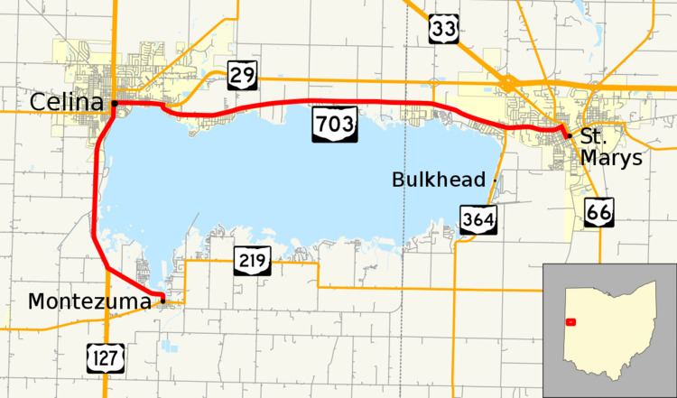
State Route 703 (SR 703) is a state highway in western Ohio. Its western terminus is in Montezuma at State Route 219, and its eastern terminus at an intersection with State Route 29, State Route 66, and the southern terminus of State Route 116 in St. Mary's. The route primarily runs along the western and northern shores of Grand Lake St. Marys, causing the route to run in more of a north-south fashion toward its western end between Celina and Montezuma. However, the route is primarily an east-west highway.
Contents
Map of OH-703, Celina, OH 45822, USA
Route description
SR 703 travels through eastern Mercer County and the westernmost portion of Auglaize County. No portion of this highway is included within the National Highway System (NHS). The NHS is a network of routes deemed to be most important for the economy, mobility and defense of the nation.
History
SR 703 was commissioned in 1937, between U.S. Route 127 (US 127) and SR 219 near the Mercer–Auglaize county line, east of Montezuma. In 1973, SR 703 was extended to St. Marys, passing on the west side of the Grand Lake St. Marys and along old SR 29 on the north side of the lake. At this time the routes western end was moved to SR 219 in Montezuma, with SR 219 replacing SR 703 east of Montezuma. Between 1977 and 1979 the route was reroute onto US 127 along the west side of the lake.