
Existed: 1937 – present Length 31.93 km | Constructed 1937 | |
 | ||
Counties | ||
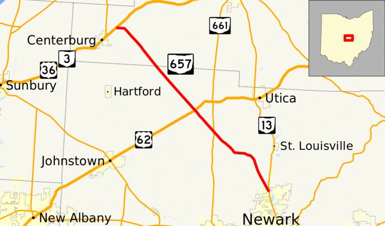
State Route 657 (SR 657) is a state highway in central Ohio, a U.S. state. While signed as a north–south route, State Route 657 actually travels in a northwest–southeast fashion. The southern terminus of the route is at a T-intersection with SR 13 immediately north of the city limits of Newark. Its northern terminus is at a T-intersection with the concurrency of US 36 and SR 3 about 1 mile (1.6 km) northeast of Centerburg.
Contents
Map of OH-657, Ohio, USA
Route description
This state highway passes through the northwestern quadrant of Licking County and the southwestern corner of Knox County. SR 657 is not included as a part of the National Highway System, a system of routes deemed most important for the nation's economy, mobility and defense.
History
SR 657 was established in 1937 along the routing between SR 13 and the US 36/SR 3 concurrency that it occupies today. No significant changes have taken place to the routing of SR 657 since its designation.