
Existed: 1938 – present Constructed 1938 | Length 38.29 km | |
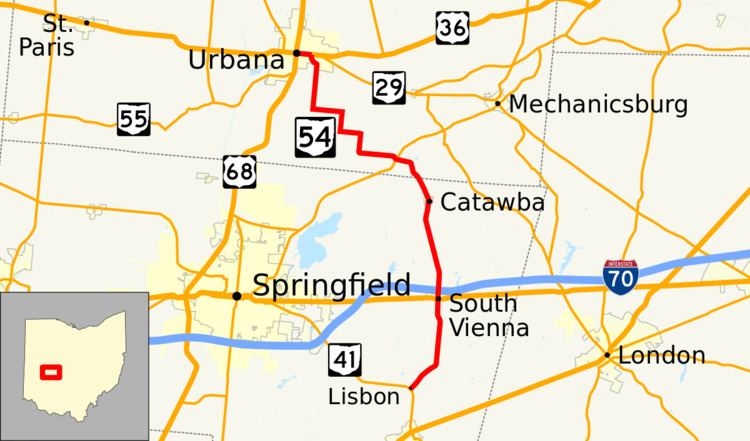 | ||
State Route 54 (SR 54) is a north–south state highway that serves west-central Ohio. It extends from Urbana in the north, to southeast of Springfield.
Contents
Map of OH-54, Ohio, USA
History
SR 54 was commissioned in 1923 between its current southern terminus and Indiana state line northwest of Willshire. The highway was routed on to mostly the current alignment of SR 29 and US 33, and its current alignment. In 1938 the northern terminus was moved to the Indiana state line west of Celina. One year later SR 54 between Urbana and Indiana state line became SR 29, leaving SR 54 on its current alignment.
References
Ohio State Route 54 Wikipedia(Text) CC BY-SA