
Existed: 1935 – present North end: SR 147 in Batesville Constructed 1935 | Length 23.71 km | |
 | ||
Counties | ||
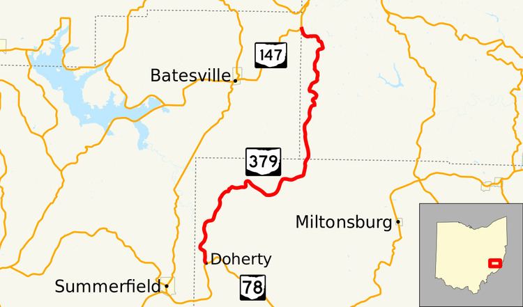
State Route 379 (SR 379, OH 379) is a north–south state highway located in the southeastern quadrant of the U.S. state of Ohio. The highway runs from its southern terminus at a T-intersection with State Route 78 nearly 3.25 miles (5.23 km) northeast of Summerfield to its northern terminus at a Y-intersection with State Route 147 about 3.75 miles (6.04 km) northeast of Batesville on the Noble-Belmont County Line.
Contents
Map of OH-379, Ohio, USA
Route description
Along its path, State Route 379 passes through northwestern Monroe County and southwestern Belmont County. This state highway is not included as a part of the National Highway System, a system of routes identified as being most important for the economy, mobility and defense of the nation.
History
The State Route 379 designation was assigned in 1935. Originally, the highway was a spur route, running along its current alignment from its present northern terminus at State Route 147 southwesterly to the northwestern Monroe County hamlet of Calais. Two years later, State Route 379 was extended to the southwest from Calais to end at its present southern terminus at State Route 78.