
Existed: 1934 – present Counties: Scioto Constructed 1934 | Length 600 m | |
 | ||
South end: Shawnee State Park near Otway | ||
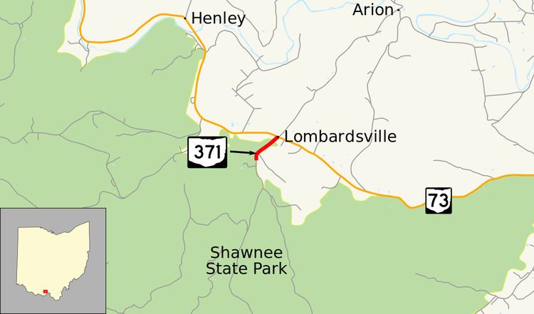
State Route 371 (SR 371) is very short north–south state highway in the south central portion of Ohio. Its southern terminus is at a ranger station in Shawnee State Park, and its northern terminus is at SR 73 approximately six miles (9.7 km) southeast of Otway.
Contents
Map of OH-371, McDermott, OH 45652, USA
Created in the mid-1930s, this two-lane spur highway, whose entire length is just 0.40 miles (0.64 km), provides access to Shawnee State Park from SR 73.
Route description
All of SR 371 is situated within Scioto County's Union Township. It is not included as a part of the National Highway System.
Starting from a ranger station at the entrance to Shawnee State Park, SR 371 starts out heading northerly, then bending to the northeast, bounded by woods on the west side and fields on the east side, with a couple of residences and one church lining the route. After just 0.40 miles (0.64 km), SR 371 comes to an end as it meets SR 73.
History
This short spur route was first designated in 1934 along its current path, and has not undergone any major changes since its inception.
Major intersections
The entire route is in Union Township, Scioto County.