
Existed: 1938 – present Length 3.12 km | Constructed 1938 | |
 | ||
West end: SR 79 in Walnut Township Counties Fairfield County, Ohio, Licking County, Ohio | ||
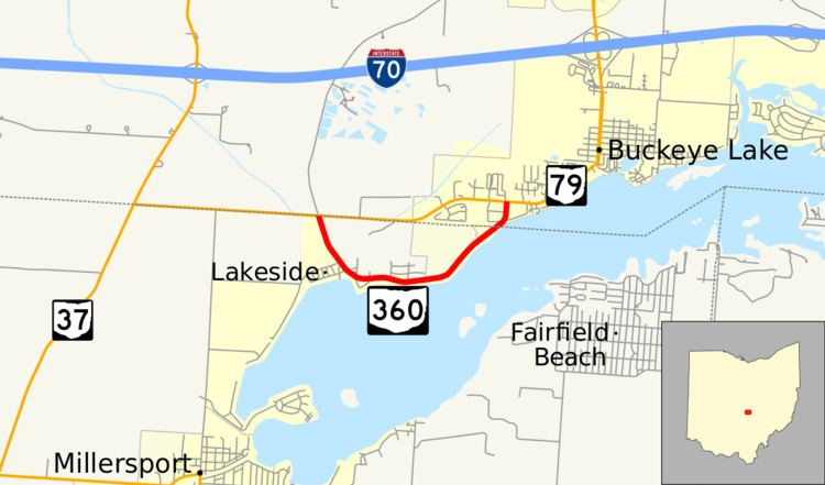
State Route 360 (SR 360) is a short east–west route in Buckeye Lake, Ohio. SR 360 starts and ends at SR 79, paralleled to the shore of Buckeye Lake. The route was designated in 1938, and has not changed significantly since.
Contents
Map of OH-360, Millersport, OH 43046, USA
Route description
SR 360 is mostly in Fairfield County, with a small part in Licking County. It is aligned to a part of the northern shore of Buckeye Lake. SR 360 is also known as North Bank Road, a undivided highway. Some parts of the centerline are covered by pothole repairs. Around 730 cars travel the road annually on average at the beginning of the route, and 1,270 near the end of the route.
The road starts at an at-grade intersection of SR 79 and Canal Road. Then, it moves southeast and parallels Buckeye Lake. After a bit more than a mile later, SR 360 heads north and ends at SR 79. Majority of the route is inside residential areas. Despite being near Buckeye Lake, the lake is not visible from the road. The route's path is that of an irregularly shaped "U", with westernmost and easternmost of the route following north–south roads.
History
SR 360 was created in 1938, and no routing changes were made since. SR 360's road surface changed from gravel to asphalt between 1961 and 1962, and was repaved in 1986 and 1999.