
Existed: 1933 – present Length 20.74 km | South end: SR 151 near Scio Constructed 1933 | |
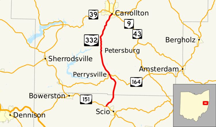 | ||
North end: SR 9 / SR 39 / SR 43 in Carrollton Counties Harrison County, Ohio, Carroll County, Ohio | ||
State Route 332 (SR 332) is a north–south state highway in the eastern portion of the U.S. state of Ohio. The highway's southern terminus is at a T-intersection with State Route 151 approximately 0.75 miles (1.21 km) northwest of the village limits of Scio. Its northern terminus is in downtown Carrollton at its junction with the triplex of State Route 9, State Route 39 and State Route 43.
Contents
Map of OH-332, Ohio, USA
Route description
Along its way, State Route 332 passes through portions of Harrison and Carroll Counties. This state route is not included as a part of the National Highway System, a network of highways deemed most important for the economy, mobility and defense of the nation.
History
State Route 332 first appeared in 1933, routed along the alignment that it maintains to this day through northern Harrison County and southern Carroll County. No changes of major significance have taken place to the highway since its designation.