
Existed: 1932 – present Length 29.74 km | Constructed 1932 | |
 | ||
East end: US 40 near Saint Clairsville | ||
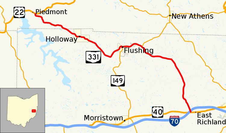
State Route 331 (SR 331, OH 331) is an east–west state highway in the eastern portion of the U.S. state of Ohio. State Route 331 has its western terminus at U.S. Route 22 approximately 4 miles (6.4 km) northwest of the village of Holloway. Its eastern terminus is at a signalized intersection with U.S. Route 40 nearly 2.75 miles (4.43 km) west of Saint Clairsville, and immediately south of Exit 213 off of Interstate 70.
Contents
Map of OH-331, Ohio, USA
Route description
Along its way, State Route 331 passes through portions of Harrison and Belmont Counties. There are no stretches of State Route 331 that are incorporated within the National Highway System, a system of highways determined to be most important for the country's economy, mobility and defense.
History
State Route 331 made its debut in 1932. Originally, the highway ran from its current western terminus at U.S. Route 22 northwest of Holloway to its current western junction with State Route 149 in Flushing. In 1939, State Route 331 took on the shape that it has today when it was extended southeasterly from Flushing to its current eastern terminus at U.S. Route 40 west of Saint Clairsville.