
Length 4.8 km | Counties: Knox | |
 | ||
North end: US 62 near Mount Vernon | ||
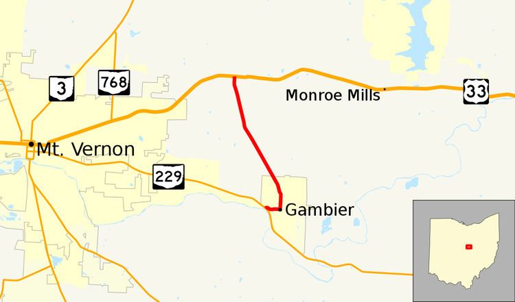
State Route 308 (SR 308) is a north–south state highway in the central portion of Ohio, a U.S. state. The southern terminus of SR 308 is at SR 229 in the western end of the village of Gambier, and its northern terminus is three miles (4.8 km) to the north of that point at a T-intersection with U.S. Route 36 (US 36) that is located approximately one and a half miles (2.4 km) east of the city limits of Mount Vernon.
Contents
Map of OH-308, Ohio, USA
Route description
SR 308 runs exclusively in the central portion of Knox County. The route is not a part of the National Highway System.
History
When first designated in 1932, SR 308 was a spur route connecting US 36 with the village of Gambier and Kenyon College. It would be 1939 before SR 308 would become a connector route, when SR 229 was extended east of Mount Vernon, and in the process connected with SR 308 at its southern terminus.
Major intersections
The entire route is in Knox County.