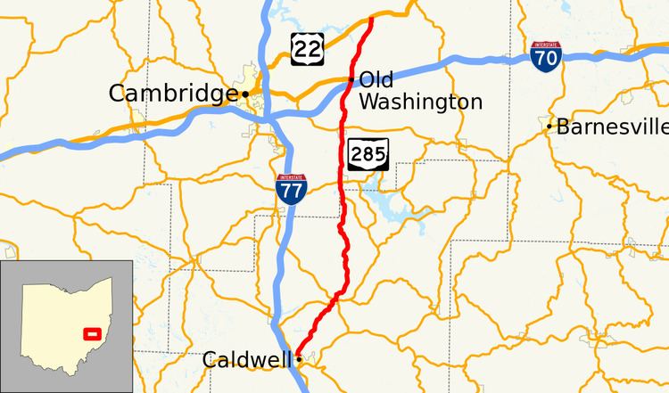
Existed: 1931 – present Length 45.11 km | Constructed 1931 | |
 | ||
Counties Noble County, Ohio, Guernsey County, Ohio | ||
State Route 285 (SR 285) is a 28.03-mile (45.11 km) long state highway in eastern Ohio. The route runs from SR 821 in Caldwell, Ohio, the county seat of Noble County, to US 22 in Madison Township, Guernsey County.
Contents
Map of OH-285, Ohio, USA
Route description
No segment of SR 285 is included within the National Highway System.
History
SR 285 was first designated in 1931 as an gravel spur route from SR 265 near Lore City to Senecaville. Within one year, the route was extended north via an dirt road to US 40 in Old Washington. By 1935, the route was extended to its current northern terminus at US 22. SR 285 was extended to its current southern terminus in Caldwell (at the time, US 21) by 1937. No major changes have occurred to the route since that time.
References
Ohio State Route 285 Wikipedia(Text) CC BY-SA
