
Existed: 1932 – present West end: US 6 in Cleveland Length 47.89 km | Touristroutes: LECT Constructed 1932 | |
 | ||
Counties | ||
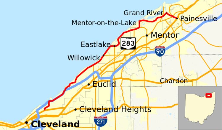
State Route 283 (SR 283) is an east–west state highway in the northeastern portion of the U.S. state of Ohio. Its western terminus at U.S. Route 6 2½ miles northeast of Downtown Cleveland, and its eastern terminus at U.S. Route 20 (Erie Street) in Painesville. Most of the route is known as Lake Shore Boulevard until it approaches the Grand River in Lake County. During its final stretch, its name changes to Olive Street, River Street, and finally to Richmond Street. The entire highway is part of the Lake Erie Circle Tour.
Contents
Map of OH-283, Ohio, USA
History
References
Ohio State Route 283 Wikipedia(Text) CC BY-SA