
Existed: 1926 – present Length 22.31 km | Counties: Morgan Constructed 1926 | |
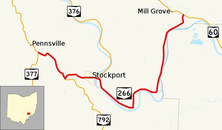 | ||
State Route 266 (SR 266, OH 266) is an east–west state highway located in the southeastern portion of Ohio. State Route 266's western terminus is at a Y-intersection with State Route 377 nearly 3.5 miles (5.6 km) northwest of Stockport, and its eastern terminus is at another Y-intersection, this time with State Route 60 approximately 4.5 miles (7.2 km) northwest of Beverly.
Contents
Map of OH-266, Stockport, OH 43787, USA
Located in southeastern Morgan County, State Route 266 was first designated in the middle of the 1920s along its current routing. The highway serves the village of Stockport. From the State Route 376 intersection to its eastern terminus at State Route 60, State Route 266 generally straddles the northern banks of the Muskingum River.
Route description
The entirety of State Route 266 is within the confines of southeastern Morgan County. There is no portion of State Route 266 that is included within the National Highway System.
History
State Route 266 was first designated in 1926 along the routing within southeastern Morgan County that it occupies to this day. There have been no significant changes to the route since its inception.
Major intersections
The entire route is in Morgan County.