
Existed: 1923 – present Constructed 1923 | Length 35.6 km | |
 | ||
Counties | ||
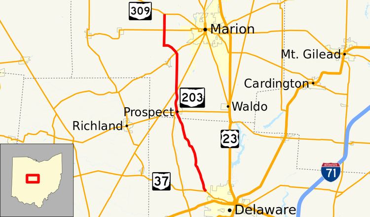
State Route 203 (SR 203, OH 203) is a 22.14-mile (35.63 km) long north–south state highway in the central portion of the U.S. state of Ohio. The southern terminus of SR 203 is at a four-way stop intersection with SR 37 just 0.50 miles (0.80 km) northwest of the city limits of Delaware. Its northern terminus is at SR 309 approximately 4 miles (6.4 km) northwest of Marion.
Contents
Map of OH-203, Ohio, USA
Route description
SR 203 traverses the northwestern portion of Delaware County and the southern half of Marion County. There are no segments of SR 203 that are included within the National Highway System (NHS), a network of highways deemed to be most important for the economy, mobility and defense of the country.
History
SR 203 was established in 1923. The highway was originally routed along its current alignment between its present southern terminus, at the time designated as SR 47, and its junction with what is now SR 739, but in 1923 known as SR 38. In 1938, SR 203 was extended north to its present terminus at what is now SR 309, but at the time a part of the now-defunct U.S. Route 30S (US 30S).