
Existed: 1924 – present Constructed 1924 | Length 20.15 km | |
 | ||
Counties | ||
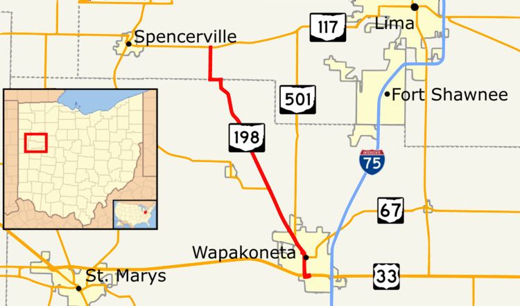
State Route 198 is a north–south state highway in the western portion of the U.S. state of Ohio. Its southern terminus is at an interchange with U.S. Route 33 just south of Wapakoneta, which is also the western terminus of State Route 67 and the southern terminus of State Route 501; its northern terminus is at State Route 117 nearly 4 miles (6.4 km) east of Spencerville.
Contents
Map of OH-198, Ohio, USA
Route description
No part of SR 198 in Ohio is included as a part of the National Highway System (NHS). The NHS is a network of highways that are identified as being most important for the economy, mobility and defense of the nation.
SR 198 heads north from an interchange with U.S. Route 33 concurrent with SR 67 and SR 501. The road enter downtown Wapakoneta where SR 67 turns east and both SR 198 and SR 501 turn west. The two routes head west and then turns towards the northwest. Just before leaving Wapakoeta SR 501 leaves the concuurency heading due north. The highway now enters rural Auglaize County passing through farmland. Before the road enters Allen County is an intersection with SR 197. The route enters Allen County and has an intersection with SR 117. This intersection is the northern terminus of SR 117.