
Existed: 1923 – present Length 16.43 km | Constructed 1923 | |
 | ||
Counties | ||
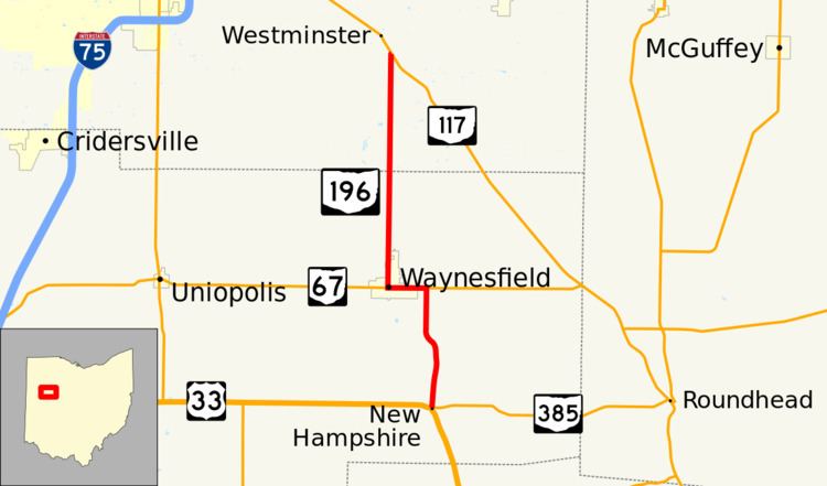
State Route 196 (SR 196) is a 10.21-mile (16.43 km) long north–south state highway in the western portion of the U.S. state of Ohio. The southern terminus of SR 196 is at a signalized intersection nearly 3.50 miles (5.63 km) southeast of Waynesfield that marks its junction with U.S. Route 33 (US 33) and SR 385, which has its western terminus at the same location. The northern terminus of SR 196 is at a T-intersection with SR 117 about 4.25 miles (6.84 km) southwest of Harrod.
Contents
Map of OH-196, Waynesfield, OH 45896, USA
Route description
Along its way, SR 196 travels through the eastern part of Auglaize County and the southeastern portion of Allen County. There is no portion of SR 196 that is included within the National Highway System (NHS). The NHS is a system of routes deemed to be most important for the economy, mobility and defense of the country.
History
The debut of SR 196 took place in 1923. Since its inception, the highway has maintained the same routing through eastern Auglaize and southeastern Allen Counties.