
Existed: 1927 – present Length 47.56 km | Constructed 1927 | |
 | ||
Counties | ||
State Route 180 (SR 180) is a 29.55-mile (47.56 km) long east–west state highway in the southern portion of the U.S. state of Ohio. SR 180 has its western terminus at a T-intersection with SR 159 nearly 5 miles (8.0 km) northeast of Chillicothe. Its eastern terminus is at a diamond interchange with the U.S. Route 33 (US 33) expressway approximately 3.75 miles (6.04 km) northwest of Logan.
Contents
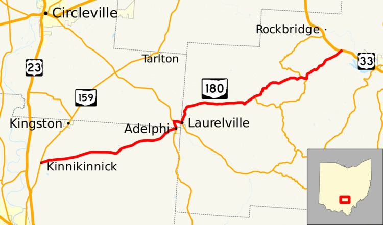
Map of OH-180, Ohio, USA
Route description
Along its path, SR 180 travels through northeastern Ross County, the extreme southeastern corner of Pickaway County and the northwestern part of Hocking County. No portion of this highway is included within the National Highway System (NHS). The NHS is a network of routes determined to be most important for the economy, mobility and defense of the nation.
History
The SR 180 designation was applied in 1927. Prior to this time, the stretch of highway that SR 180 currently occupies through Ross, Pickaway and Hocking Counties was designated as SR 27. With the designation of the US 27 in that year, SR 27 was replaced by SR 180. The only change related to SR 180 since its inception has been the highway that it meets at its eastern terminus, which at the time was the predecessor to US 33, SR 31.