
Existed: 1924 – present Constructed 1924 | Length 18.93 km | |
 | ||
Counties | ||
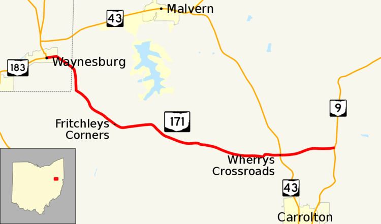
State Route 171 (SR 171) is a west–east state highway located in northeastern Ohio, a U.S. state. The highway's western terminus is at a signalized intersection with State Route 183 in Waynesburg. The eastern terminus of State Route 171 is at State Route 9 approximately 2 miles (3.2 km) north of Carrollton.
Contents
Map of OH-171, Ohio, USA
Route description
State Route 171's routing takes it through the southeastern corner of Stark County and the northwestern portion of Carroll County. No part of State Route 171 is included within the National Highway System.
History
When it was originally designated in 1924, State Route 171 ran from its current western terminus in Waynesburg through New Harrisburg to its junction with State Route 43 northwest of Carrollton. In 1937, the highway was extended eastward to State Route 9, then continuing east via Carroll County Road 71 to a new terminus at State Route 39 just west of Mechanicstown. By 1967, State Route 171 was truncated to its current eastern terminus at State Route 9, with jurisdiction of the portion between State Route 9 and State Route 39 being transferred to Carroll County. This stretch of roadway was renamed County Road 71.