
Existed: 1923 – present Length 49.74 km | Constructed 1923 | |
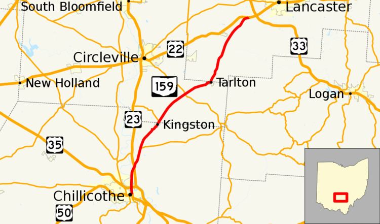 | ||
State Route 159 (SR 159) is a northeast-southwest state highway (signed north–south) in the south-central portion of the U.S. state of Ohio. Its southern terminus is in Chillicothe at the U.S. Route 50 and State Route 104 concurrency; its northern terminus is at U.S. Route 22 approximately 4 miles (6.4 km) southeast Lancaster.
Contents
Map of OH-159, Ohio, USA
History
SR 159 was original signed in 1923, on much of its current alignment. In 1927 the route was extended south to US 23, along the alignment of former State Route 27. The first section of road paved was in 1933 and it was a section from the southern terminus to Meade. In 1935 the second section was paved between Meade and Tarlton. The final section of the roadway was paved between Tarlton and the northern terminus, in 1938. The route was extended north to its current terminus along the former alignment of U.S. Route 22, in 1971. In 1972 the highway was extended south to its current terminus along the former alignment of U.S. Route 23.