
Length 74.25 km | ||
 | ||
Counties | ||
Ohio state route 145 rt 78 south to stafford and back twisty
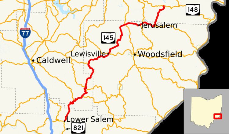
State Route 145 (SR 145, OH 145) is a 46.14-mile (74.26 km) long north–south state highway in the southeastern quadrant of the U.S. state of Ohio. The western terminus of SR 145 is at a T-intersection with SR 821 in Lower Salem. Its eastern terminus is at a T-intersection with SR 148 approximately 5.25 miles (8.45 km) northeast of Beallsville.
Contents
- Ohio state route 145 rt 78 south to stafford and back twisty
- Map of OH 145 Ohio USA
- Route description
- History
- References
Map of OH-145, Ohio, USA
Route description
Along its path, SR 145 passes through northern Washington County, the southeastern Noble County, northwestern Monroe County and southern Belmont County. No part of SR 145 is included as a part of the National Highway System.
History
The SR 145 designation was applied in 1923. It was originally routed from its southern terminus in Lower Salem to its junction with SR 78 in Lewisville. SR 145 was extended to the north in 1937, routed from SR 78 in Lewisville to then-SR 8 in Malaga.