
Length 214 km Source elevation 900 m Mouth Saône | Basin size 2,308 km (891 sq mi) Discharge 36 m³/s Source Vosges | |
 | ||
Main source Vosges mountains±900 m (3,000 ft) Progression Saône→ Rhône→ Mediterranean Sea | ||
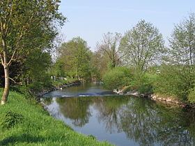
The Ognon is a river of eastern France. It is a left tributary of the Saône, which it joins in Pontailler-sur-Saône. Its source is in Haut-du-Them-Château-Lambert in the Vosges mountains near the Ballon d'Alsace. Its length is 214 km (133 mi) and its basin area is 2,308 km2 (891 sq mi).
Contents
Map of Ognon, France
The Ognon flows through the following départements and towns:
References
Ognon (Franche-Comté) Wikipedia(Text) CC BY-SA