
Local time Thursday 2:34 AM Dialling code 01656 | Country Wales Postcode district CF32 | |
 | ||
Weather 2°C, Wind NE at 13 km/h, 86% Humidity | ||
Ogmore-by-Sea (Welsh: Aberogwr, meaning "Mouth of the River Ogmore") is a seaside village in St Brides Major community in the Vale of Glamorgan, Wales. Ogmore river probably takes its name from the large caves on the seashore by the river mouth , ogof being the Welsh word for cave. It lies on the western limit of the Glamorgan Heritage Coast of south Wales.
Contents
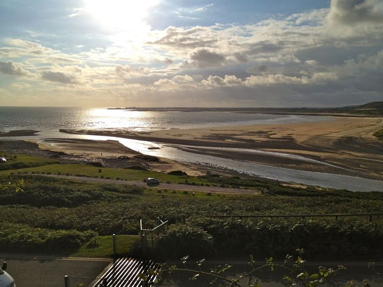
Map of Ogmore-by-Sea, Bridgend, UK
History
A polished flint axe-head of Seamer type was found at Ogmore Mill in 1976.
Just like its counterparts in Cornwall, Ireland and Brittany, the west-facing beach and coast was notorious as a graveyard for ships during strong on-shore winds (i.e. south-westerly winds from the Atlantic). Many ships in particular were destroyed on Tusker Rock, a brutal reef slightly out to sea that is totally covered at high tide. There are urban legends of organised shipwrecking at Ogmore (and all across the Vale of Glamorgan coastline); similar to tales from Cornwall of the use of false lights so passing ships would mistake a flickering light as a lighthouse or ship at anchor and be lured to destruction, however there is no historical evidence for this.
Geography
Ogmore-by-Sea is about 3 miles south of Bridgend and about 20 miles west of Cardiff. The beaches look out on Tusker Rock, and have sand at low-tide and sharp rocks at high-tide.
The River Ogmore estuary is flanked by Ogmore beach on one side and the dunes of Merthyr Mawr on the other. The estuary makes bathing unsafe from most of the beach. The rocky shoreline is well known as a rock climbing location. It is an interesting place geologically with a variety of fossils clearly visible. Many people use the car-park by the estuary to the River Ogmore, which is just as you enter the village, others move on to Southerndown. Ogmore had many beaches and if you walk along the path from the car park you will find Hardies Bay and Horseshoe Bay which are fantastic for bathing. Further on below Brig Y Don hill there are the deeps with cave and secluded coves but you have to watch the tide times here. Also the deeps is favoured for fishing especially at night when the tide is in. Ogmore by Sea is a jewel often missed by tourists because of the parking.
Geology
The rocks exposed along the stretch of coast near Ogmore-by-Sea were laid down between 340 and 195 million years ago. They are all sedimentary rocks, originally deposited as lime, mud, sand and coarse pebbles, and over long periods of time these were compacted and solidified into limestone, shale and conglomerate.
The oldest rocks are hard, grey limestones that make up the Carboniferous Limestone. These were laid down in a warm, shallow, subtropical sea and are rich in fossils, especially corals, crinoids and brachiopods. About 300 million years ago movements in the Earth's crust deformed and folded the rocks, as a result of which the rocks above the Carboniferous Limestone were worn away. Deposition resumed during the Triassic Period when the area was a desert with hills of limestone, and a dry plain where the Bristol Channel is now. Short violent storms caused flash-floods which carried debris down the hillsides and deposited it as alluvial fans of coarse, red conglomerate at the edge of the plain. These Triassic lie unconformably on the Carboniferous Limestone.
About 205 million years ago, at the beginning of the Jurassic Period, the sea began to drown the land and the limestone hills became islands before finally being submerged. Sutton Stone, which contains pebbles of Carboniferous Limestone, represents rocks deposited close to the shore of these islands. In deeper water the Southerndown Beds were deposited. Finally, when deep water covered the area the alternating limestones and shales of the Blue Lias were deposited.
After the early Jurassic no evidence of geological events is preserved until the end of the last Ice Age (about 10,000 years ago). Fluctuating sea levels caused by the growth and melting of the ice sheets affected the shape of the landscape, and the present-day coastline has been moulded into its present shape by both subaerial and marine erosion, both of which continue today.
Notable landmarks
Ogmore centre was built in the 1930s for the benefit of children from all over South Wales. It was closed in the mid-1990s, but was reopened as a Trust in 1998 and continued as such until 2007. Southerndown Golf Club and Portobello House are nearby.