
Founded January 16, 1836 Area 1,976 km² | Website www.oglecounty.org Population 52,385 (2013) Unemployment rate 5.5% (Apr 2015) | |
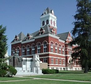 | ||
Rivers Rock River, Killbuck Creek, Elkhorn Creek, Otter Creek Points of interest Destinations | ||
Ogle County is a county located in the U.S. state of Illinois. According to the 2010 census, it had a population of 53,497. Its county seat is Oregon, and its largest city is Rochelle.
Contents
- Map of Ogle County IL USA
- History
- Geography
- Climate
- Adjacent counties
- Demographics
- Politics
- Economy
- Airports
- Parks
- Nature Preserves
- Cities
- Census designated places
- References
Map of Ogle County, IL, USA
Ogle County comprises Rochelle, IL Micropolitan Statistical Area, which is also included in the Rockford-Freeport-Rochelle, IL Combined Statistical Area.
History
Ogle County was formed in 1836 out of Jo Daviess and LaSalle counties, and named in honor of Captain Joseph Ogle, a veteran of the Revolutionary War who came to Illinois in 1785. Ogle did not have an organized government until 1837, so for a year it remained attached to Jo Daviess County. The county was divided three years later in 1839, when Lee County was formed.
Ogle County was a New England settlement. The original founders of Oregon and Rochelle consisted entirely of settlers from New England. These people were "Yankees", that is to say they were descended from the English Puritans who settled New England in the 1600s. They were part of a wave of New England farmers who headed west into what was then the wilds of the Northwest Territory during the early 1800s. Most of them arrived as a result of the completion of the Erie Canal. When they arrived in what is now Ogle County there was nothing but a virgin forest and wild prairie, the New Englanders laid out farms, constructed roads, erected government buildings and established post routes. They brought with them many of their Yankee New England values, such as a passion for education, establishing many schools as well as staunch support for abolitionism. They were mostly members of the Congregationalist Church though some were Episcopalian. Culturally Ogle County, like much of northern Illinois would be culturally very continuous with early New England culture, for most of its history.
Geography
According to the U.S. Census Bureau, the county has a total area of 763 square miles (1,980 km2), of which 759 square miles (1,970 km2) is land and 4.4 square miles (11 km2) (0.6%) is water.
Climate
In recent years, average temperatures in Oregon have ranged from a low of 10 °F (−12 °C) in January to a high of 82 °F (28 °C) in July, although a record low of −27 °F (−33 °C) was recorded in January 1999 and a record high of 110 °F (43 °C) was recorded in July 1936. Average monthly precipitation ranged from 1.43 inches (36 mm) in February to 4.88 inches (124 mm) in June.
Adjacent counties
Demographics
As of the 2010 United States Census, there were 53,497 people, 20,856 households, and 14,711 families residing in the county. The population density was 70.5 inhabitants per square mile (27.2/km2). There were 22,561 housing units at an average density of 29.7 per square mile (11.5/km2). The racial makeup of the county was 93.2% white, 0.9% black or African American, 0.5% Asian, 0.2% American Indian, 3.8% from other races, and 1.4% from two or more races. Those of Hispanic or Latino origin made up 8.9% of the population. In terms of ancestry, 38.0% were German, 15.3% were Irish, 10.2% were English, 6.4% were American, 5.3% were Swedish, and 5.3% were Norwegian.
Of the 20,856 households, 33.1% had children under the age of 18 living with them, 56.1% were married couples living together, 9.7% had a female householder with no husband present, 29.5% were non-families, and 24.5% of all households were made up of individuals. The average household size was 2.54 and the average family size was 3.01. The median age was 40.7 years.
The median income for a household in the county was $55,733 and the median income for a family was $64,927. Males had a median income of $49,996 versus $32,082 for females. The per capita income for the county was $24,959. About 6.6% of families and 8.9% of the population were below the poverty line, including 12.4% of those under age 18 and 5.9% of those age 65 or over.
Politics
Along with its neighbor Lee County, Ogle County is one of the most consistently Republican counties in the nation when it comes to Presidential elections. In the last 150 years, Theodore Roosevelt's 1912 run as a Progressive was the only time a non-Republican carried the county. No Democratic candidate has ever won the county, which favored the Whig Party before the Republican Party was formed. It is also represented by Republican Adam Kinzinger as a county in Illinois's 16th congressional district.
Economy
By 2000, 65% of the county labor force was employed as white-collar workers with an increase of 20 points in comparison with 1990 statistics. Manufacturing remains the leading employment sector absorbing more than 21.7% of the labor force though there was a decrease from 30,4% in 1995. However it is expected that services would replace manufacturing starting 2015 as the leading activity.
Agriculture remains an important sector of the county. The main products are corn and soybeans. In 2003, according to the Illinois Department of Agriculture, Ogle County was ranked 17th in the State for crop cash receipts, and 14th in the state for livestock cash receipts. As for livestock production, hogs and pigs are still leading even though productions decreased from 57,000 units in 1998 to 48,900 in 2002.
The county also got some investment packages such as the building a $180 million truck-to-train cargo hub. In August 2006, it was announced that a new ethanol production facility would receive a package of $5.5 million Opportunity Returns grant from the State.
Airports
The following public-use airports are located in the county: