
OS grid reference SU178121 Post town FORDINGBRIDGE Dialling code 01425 | Sovereign state United Kingdom Postcode district SP6 | |
 | ||
Ogdens is a small hamlet south of Hyde Common near Frogham in the New Forest area of Hampshire, England.
Map of Ogdens, Fordingbridge, UK
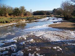
Ogdens is a hamlet in the civil parish of Hyde(where the 2011 Census population was included). It is situated in the valley of Latchmore Brook (or Huckles Brook). Most of the settlement is surrounded by the heathland and woodland of the New Forest. The hamlet is very rural with a few post-war dwellings, mixed in with older houses scattered on tracks and farmland. There is a car park at Ogdens allowing access to the heathland of the New Forest. Nearby is Ogdens Purlieu, a boggy area of heathland between Ogdens and Dockens Water.
The hamlet is named after Ogden Rooke, a local landowner who possessed Ogdens Purlieu in the latter half of the 17th century. Purlieu is a Norman-French word meaning "the outskirts of a forest" – a place free from forest laws.