
Location Lancashire, England Area 9 ha | Built 1906 and 1914 | |
 | ||
Surface area 2.84 and 8.55 ha (7.0 and 21.1 acres) Max. depth 17.9 and 18 m (59 and 59 ft) Water volume 247,755 and 715,989 m (200.858 and 580.462 acre·ft) | ||
Upper and lower ogden reservoirs pendle
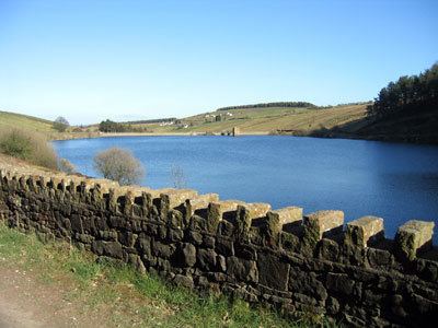
Upper and Lower Ogden Reservoirs are half a mile to the west of the village of Barley, in the Borough of Pendle. They supply drinking water to the town of Nelson.
Contents
Map of Ogden Reservoirs, Burnley, UK
Three forests covering more than 23 hectares (57 acres) can be found close to the reservoirs. Fell Wood, which is the largest, was planted in 1931 and contains Norway Spruce (Picea abies), Sitka Spruce (Picea sitchensis), Scots Pine (Pinus sylvestris) and European Larch (Larix decidua). Blue Wood, which was originally planted in 1935 with Scots Pine, Sitka Spruce and Larch was felled and replanted in 1981. The third forest: Buttock Plantation, was planted in 1935 with Sitka Spruce and Larch.
References
Ogden Reservoirs Wikipedia(Text) CC BY-SA