
Area 37,658 km² | Regional capital Nzérékoré | |
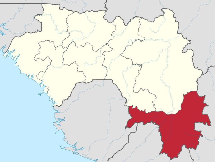 | ||
The Nzérékoré Region is a region in the southern part of Guinea. Its capital and largest city is Nzérékoré. It is one of the eight regions of Guinea. It is bordered by the countries of Sierra Leone, Liberia, and Côte d'Ivoire and the Guinean regions of Kankan and Faranah.
Contents
Map of Nz%C3%A9r%C3%A9kor%C3%A9, Guinea
The prefectures of Nzérékoré Region include:
Geography
Nzérékoré Region is traversed by the northwesterly line of equal latitude and longitude.
The region includes several forested highlands, including the Nimba Range, Simandou Massif, and Ziama Massif.
The region contains the headwaters of several rivers. The Milo, Sankarani, and Dion rivers flow northward to become tributaries the Niger River. The Moa, Lofa, St. Paul, St. John, Cavalla, and Sassandra rivers flow southwards through Sierra Leone, Liberia, and Côte d'Ivoire to empty into the Atlantic Ocean.