
Country Ukraine Elevation/(average value of) 375 m (1,230 ft) Area 163 ha | Established 1691 Time zone EET (UTC+2) Local time Tuesday 1:39 PM | |
 | ||
Weather 13°C, Wind SW at 18 km/h, 72% Humidity | ||
Nyzhnie Synovydne (Ukrainian: Ни́жнє Синьови́дне, Polish: Synowódzko Niżne) is a village (selo) in Skole Raion, Lviv Oblast, of Western Ukraine. The population of the village is about 1,113 people and Local government is administered by Nyzhnosynovydnenska village council.
Contents
Map of Nyzhnje Syn'ovydne, Lvivska, Ukraine
Geography
The village is located in the river valley where the two rivers merge into one — Stryi River and Opir River.
Area of the village totals is 1,63 km2 and is located along the Highway M06 (Ukraine) (). It is situated 95 kilometres (59 mi) from the regional center Lviv, 17 kilometres (11 mi) from the district center Skole, and 173 kilometres (107 mi) from Uzhhorod.
History
The village is known from the 13th century, although the official founding date of village is 1691.
In ancient times through the village was a trade route from Kievan Rus' to Hungary.
Attractions
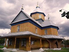
The village has two sights of architecture Skole district: