
Established XII century Time zone EET (UTC+2) Local time Tuesday 1:39 PM | Elevation/(average value of) 448 m (1,470 ft) Postal code 89130 | |
 | ||
Weather 10°C, Wind S at 8 km/h, 81% Humidity | ||
Nyzhni Vorota (Ukrainian: Ни́жні Воро́та; Hungarian: Alsóverecke, Volóci járás, by 1945 the village had the name Ukrainian: Ни́жні Вере́цьки ) is a village in Volovets Raion, Zakarpattia Oblast of Western Ukraine.
The village has around 2504 inhabitants. Local government is administered by Nyzhnovoritska village council.
Contents
Map of Nyzhni Vorota, Zakarpatska, Ukraine
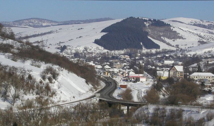
Geography
The village Nyzhni Vorota is located in the Carpathian Mountains, on the southern slopes of the Dividing Range, within Volovets Pass.
Through the village passes the Highway M06 (Ukraine) (). It is a Ukrainian international highway (M-highway) connecting Kiev to the Hungarian border near Chop, where it connects to the Hungarian Highway M34.
Distance from the regional center Uzhhorod is 97 kilometres (60 mi) , 15 kilometres (9.3 mi) from the district center Volovets, and 171 kilometres (106 mi) from Lviv.
History
By 1880, the Jewish population was 545 (of a total population of 1,276). With the Hungarian occupation in March, 1939, Jews were persecuted and pushed out of their occupations. In 1941, dozens of Jews from Nyzhni Vorota were drafted into forced labor battalions and others were drafted for service on the Eastern front, where most died. In August, 1941, a number of Jewish families (totaling 80 persons) without Hungarian citizenship were expelled to Nazi occupied Ukrainian territory, to Kamenets-Podolski, and murdered there. The remaining Jews, about 500, were deported to Auschwitz mid-May 1944.