
Primary inflows Surface area 8 acres (3.2 ha) Area 3 ha Year built 1942 | Primary outflows Nutscale Water Average depth 12.2 metres (40 ft) Shore length 1.14 km Primary outflow Nutscale Water | |
 | ||
Water volume 277,000 m (225 acre·ft) | ||
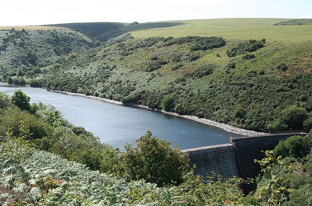
Nutscale Reservoir is a reservoir located in Exmoor in north west Somerset, England. It supplies the town of Minehead and nearby Porlock and Porlock Weir. The reservoir is part of the River Horner catchment area, and is dammed. Nutscale Reservoir is fed by Nutscale Water and water is piped to the Porlock Treatment Works, supplying around 3,000 cubic metres (110,000 cu ft) per day, and to six other farms and camp sites.
Map of Nutscale Reservoir, Minehead, UK
The reservoir was built in 1942, to hold 36,000,000 imperial gallons (160,000,000 l; 43,000,000 US gal). This was intended to relieve summer droughts in Minehead. It typically provides good quality water, although high levels of geosmin were recorded in 2008. To manage the effects of this on tap water systems were developed to remove this reservoir from the drinking water supply when necessary and flush the pipe carrying the water.
The fishing rights to the reservoir are owned by the National Trust, as part of its Holnicote Estate, and leased out privately.