
Elevation 3 m (10 ft) Lowest elevation 0 m (0 ft) Local time Tuesday 2:59 PM | Highest elevation 6 m (20 ft) Time zone – (UTC+13) Population 23,658 (2006) | |
 | ||
Weather 27°C, Wind NW at 3 km/h, 82% Humidity Points of interest Royal Palace - Tonga, Free Church of Tonga, Ancient Tonga, OTS Recreation Center | ||
Tonga nuku alofa what would you do in 4 days
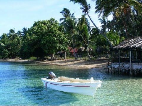
Nukuʻalofa is the capital of the Kingdom of Tonga. It is located on the north coast of the island of Tongatapu, in the southernmost island group of Tonga.
Contents
- Tonga nuku alofa what would you do in 4 days
- Map of NukuAlofa Tonga
- Mythological origins
- First western records of Nukualofa
- Capital of the Kingdom of Tonga 1875 and later
- Government
- Climate
- Economy
- Transport
- 2015 island creation
- Twin townsSister cities
- References
Map of Nuku'Alofa, Tonga
Mythological origins
In the Tongan myth of the origin of Nukuʻalofa, it was said that the meaning of Nukuʻalofa is: nuku meaning abode, ʻalofa meaning love.
The name is said to have originated when Moʻungatonga, the 6th Tuʻi Haʻatakalaua (King who governs the daily business of Tonga on behalf of the Tuʻi Tonga or Sacred King of Tonga) sent his youngest son, Ngata (later to be 1st Tuʻi Kanokupolu) as governor to Hihifo (Western side of Tongatapu). It was a difficult decision for Ngata as the Tu’i Tonga and Tu’i Ha’atakalaua have been unable to control Hihifo. Ngata had many reasons to fear for his life as his predecessors had been killed by the chiefs and people of Hihifo.
When Ngata left Muʻa, the old capital and residence of the Tuʻi Tonga and Tuʻi Ha'atakalaua, he was escorted by Nuku (an uncle) and Niukapu (an older cousin), chiefly relatives of his father. They sailed their canoes with all their followers from Muʻa and debated abandoning Tonga and sailing directly to Samoa, the homeland of Ngata’s mother. It was decided not to abandon Tonga, but to pull their canoes up into the swamp area halfway between Muʻa and Hihifo in order to plan and prepare for their landing at Hihifo.
Ngata, Nuku and Niukapu decided to wrap their combined bodies under a large mat and land in Hihifo, giving the impression of a large man with three heads. This is the origin of the ʻUlutolu (Three Head Story) and of the Haʻa Tuʻi Kanokupolu, third lineage King of Tonga. They named the swampy area as Nuku (Abode) ʻAlofa (Love) or the Abode of Love, thus Nukuʻalofa.
First western records of Nukuʻalofa
On 10 June 1777, British captain James Cook wrote of his arrival at their anchorage place. His description of the place confirmed, with his map, that this was the bay of Nukuʻalofa.
Cook never used the name Nukualofa or any other spelling for the reports of this voyage, but he mentioned the island of Pangaimodoo (Pangaimotu) which was to the east of his anchorage position. Captain Cook also wrote that he travelled by canoes to visit Mooa (Muʻa) where Paulaho and other great men lived. The house that Paulaho provided was on the beach 500 metres (1⁄3 mi) from the ship. Reference to his map shows that he must have landed and stayed in the Siesia area, the eastern part of modern Nukuʻalofa. Cook also drafted the first map of the bay of Nuku'alofa.
The first written record for Nuku'alofa is stated in the first dedicated book for Tonga by George Vason which was published in 1810. George Vason was an English missionary from the London Missionary Society, who arrived in Tonga in 1797. George Vason wrote of their arrival that:
The second oldest book dedicated to Tonga was by William Mariner, adopted son of Finau 'Ulukalala, which was published in 1817. Mariner described his experiences during the years he was the adopted son of 'Ulukalala (1806–1810). He described the civil war and the siege of the Fort of Nuku'alofa, which fell to 'Ulukalala and his warriors.
The third attempt of Christian missionaries were recorded in April 1826, when two Tahitian London Missionaries were detained by Tupou the chief of Nuku'alofa.
The arrival of the Methodist missionaries in Nuku'alofa in 1827 reinforced the Christian faith. The persecution suffered by Christians in Hihifo and Hahake forced a lot of people to seek refuge in Nuku'alofa. Thanks to the encouragement of Tupou, the King of Nuku'alofa, this was the beginning of the expanding of Nuku'alofa to become the major center of Christianity in Tonga.
The final phase of the arrival of Christianity in Tonga was the arrival of Father Chevron, or Patele Sevelo, in 1842. He wrote that he arrived in Nuku'alofa in 1842 and met the Tu'i Kanokupolu Aleamotu'a who was baptised by the Wesleyan as Sosaia.
In conclusion, these arrival turned Nuku'alofa from a small village and fort into the center of Tonga during the arrival of Christianity.
From the earliest record for Nuku'alofa, the early writer always refer to the settlement as Noogollefa (1797), Nioocalofa (1806), Nukualofa (1826 by Methodist) and Noukou-Alofa (1842 by French Catholic Priest). There was no other mention of any other name of the settlement but only of the settlement or fort of Nuku'alofa.
Capital of the Kingdom of Tonga (1875 and later)
The Declaration of the Constitution of Tonga in 1875 formalised Nuku'alofa as the Capital of Tonga. King George Taufa'ahau Tupou I issued the Constitution of Tonga on 4 November 1875, in Nuku'alofa. The Constitution also stated (Article 38) that the Parliament will meet in Nuku'alofa except in time of war.
Since Nuku'alofa have been expanding from when it became the center of Christianity in Tonga in the 19th century, it became essential that it was reorganised for effective administration of the capital. The reorganisation of Nuku'alofa divided up Nuku'alofa into three major district areas:
Government
The national government is based in Nukuʻalofa. The parliament of Tonga meets there, and the Royal Palace is located near the city.
Climate
Tropical marine climate.
Economy
Nukuʻalofa is the economic hub of the country.
Peau Vavaʻu, an airline, had its head office in the Pacific Royale Hotel in Nukuʻalofa. The former Royal Tongan Airlines had its head office in the Royco Building in Nukuʻalofa.
The city has markets and a central business district. Much of the central business district was destroyed during the 2006 Nuku‘alofa riots, but it is being rebuilt.
The city has a number of tourist hotels, including the International Dateline Hotel, recently renovated.
Transport
Nukuʻalofa is the central hub for transport in Tonga.
Buses arrive and depart from the central bus station along Vuna Road close to the centre of town. Bus services are privately operated, and their drivers are free to set their own schedules. Fares are fixed by the government, with reduced rates for school children. The buses are usually filled to capacity. In addition, some schools and large hotels provide their own buses.
There are numerous taxis, also privately owned. Many people who own a car earn extra money by providing taxi services in their spare time. Taxi fares are also set by the government. Most families have their own car; few residents ride bicycles. There are no operational railways or trams in Tonga, although there was once a narrow-gauge railway from the lagoon to the wharf, which gave its name to Railway Road.
Nukuʻalofa harbour is the only deep-water harbour of the island, which determined its selection as the site for the capital. For many years Vuna Wharf was the international harbour until it was destroyed by an earthquake in 1977. A new, much larger wharf was built towards Maʻufanga, named after Queen Sālote. Between these two wharves is the wharf numbered '42', used by fishermen and inter-island ferries. It is the central hub for boats to the outer islands. There are usually two boats to ʻEua each day and two to Haʻapai and Vavaʻu each week. In addition to these regular services by shipping companies, private boat owners provide less regular services to smaller islands such as Nomuka and ʻEueiki.
Air transport is provided by Fuaʻamotu International Airport on the south side of Tongatapu, 35 kilometres from Nukuʻalofa.
2015 island creation
In January 2015, a new island of about 1 km diameter was reported to be created by a volcanic eruption. The newly formed island is situated about 65 kilometers (40 miles) northwest of the capital city.
Twin towns/Sister cities
Nukuʻalofa is twinned with: