
Country Founded 1818 | Area 415 km2 | |
 | ||
Map of Nuevitas
Nuevitas is a municipality and port town in the Camagüey Province of Cuba. The large bay was sighted by Christopher Columbus in 1492. Founded in 1775, the city was moved to its present site in 1828.
Contents
- Map of Nuevitas
- Una vuelta con coche en nuevitas cuba city tour
- Nuevitas camaguey cuba conociendo nuevitas la bella
- Geography
- Demographics
- Sister towns
- References
Una vuelta con coche en nuevitas cuba city tour
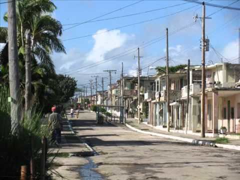
Nuevitas camaguey cuba conociendo nuevitas la bella
Geography
Nuevitas is located on the Guincho peninsula on the north coast. Nuevitas is sheltered by a huge harbor, has two auxiliary ports, and is a major shipping point for Cuban sugar as well as other products from the surrounding agricultural region. It also possesses diversified light industry and serves as a road and rail terminus.
The municipality is divided into the barrios of Primero, Segundo, Tercero, Alvaro Reinoso, Lugareño, Redención, San Miguel and Senado.
Nuevitas is not a very large city but it is one of Cuba's most important towns because of its commercial and industrial activities. Nuevitas is located not very far southwest of Playa Santa Lucía which is a very famous place for tourists in Cuba. Cayo Sabinal is located immediately north, other cays are Cayo Guajaba and Cayo Romano. The only waterway that separates Santa Lucia from Ensenada Playa Bonita is the canal of Nuevitas which connects the Bahia de Nuevitas to the Atlantic Ocean.
Demographics
In 2004, the municipality of Nuevitas had a population of 44,882. With a total area of 415 km2 (160 sq mi), it has a population density of 108.1/km2 (280/sq mi).