
Postal code 66-010 to 66-011 Population 5,036 (2006) | Time zone CET (UTC+1) Area 14.63 km² Local time Monday 8:00 PM | |
 | ||
City rights 13th century - 19451988 - Weather 11°C, Wind SW at 11 km/h, 77% Humidity | ||
Nowogr d bobrza ski w obiektywie
Nowogród Bobrzański ['nɔˈvɔɡrut bɔˈbʐaɲskʲi] (German: Naumburg am Bober) is a town on the Bóbr river in Zielona Góra County, Lubusz Voivodeship, Poland, with 5,068 inhabitants (2004). It is the administrative seat of the Gmina Nowogród Bobrzański. The gmina community was created through the integration of Nowogród Bobrzański with the nearby Krzystkowice, bringing the total number of inhabitants to 9,481. It covers the area of 259,4 km².
Contents
- Nowogr d bobrza ski w obiektywie
- Map of Nowogrod Bobrzanski Poland
- Fkf 01 2017 filmowa kronika fibera nowogr d bobrza ski
- History
- Geography
- Points of interest
- References
Map of Nowogrod Bobrzanski, Poland
Fkf 01 2017 filmowa kronika fibera nowogr d bobrza ski
History
The historic town was established in 1202 on the eastern banks of the Bóbr as the seat of a Castellan of Lower Silesia. The Piast duke Henry I the Bearded established a college of Augustinian canons here in 1217. From 1274 Nowogród Bobrzański was part of the Silesian Duchy of Żagań. It received city rights in 1314. It was consumed by fire and destroyed by plagues in 1350, 1479 and 1723. In 1827 mineral springs were discovered and many tourists began to arrive.
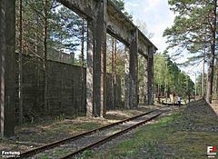
Naumburg am Bober was the seat of the firm Ostdeutsche Tiefbau GmbH ("East German Civil Engineering, Inc."), which was one of the contractors responsible for razing the Warsaw Ghetto. Nowogród lost its city rights in 1945 following World War II due to depopulation, and again acquired them in 1988 by the merger with the adjacent Lower Lusatian town of Krzystkowice (Christianstadt), the site of the Nazi German subcamp of Gross Rosen with an estimated number of 40,000 Polish and other victims. After World War II the town became part of Poland following the post-war Potsdam Agreement.
The community includes the town of Nowogród Bobrzański and 26 villages: Białowice, Bogaczów, Cieszów, Dobroszów Mały, Dobroszów Wielki, Drągowina, Kaczenice, Kamionka, Klępina, Kotowice, Krzewina, Krzywa, Lagoda, Niwska, Pajęczno, Pielice, Pierzwin, Podgórzyce, Popowiec, Przybymierz, Skibice, Sobolice, Sterków, Turów, Urzuty, Wysoka.
Geography
The highest hill has 166.4 meters altitude. There are two rivers: the Bóbr and the Brzeźniczanka. Woods take up 60% of the land. The forest covers an area of 30.568 hectares (75.54 acres) and is divided into 22 parks. Overall, the forest constitutes 16,5% of Zielona Góra district. The pine is the most common tree. The age of an average tree is about 48 years. The annual growth of trees is 2,65 cubic metres per one hectare. The abundance of trees is high, as it is about 125 cubic metres for one hectare. There are two nurseries: Tuchola, and Guzów.
The Forest Inspectorate of Nowogród Bobrzański manages the following protection areas:
Points of interest
In the town there are a number of tourist attractions such as:
In the community outside the town there are also tourist destinations such as: