
Time zone CET (UTC+1) Website Official website | Communities 23 Area code(s) +387 33 Local time Monday 2:19 PM | |
 | ||
Weather 21°C, Wind SE at 6 km/h, 34% Humidity | ||
Novi Grad ([nôʋiː grâːd]; translated New Town) is the westernmost of the four municipalities that make up the city of Sarajevo, Sarajevo Canton in Bosnia and Herzegovina.
Contents
- Map of Novi Grad Sarajevo Bosnia and Herzegovina
- History
- 1971
- 1991
- 2002
- 2005
- 2013
- Communities and neighborhoods in Novi Grad
- References
Map of Novi Grad Sarajevo, Bosnia and Herzegovina
History
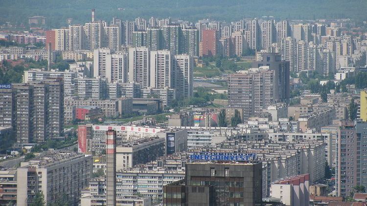
During the 1970s, Sarajevo was undergoing a rapid economic and cultural development, with great expansion focused on population and industry. Novi Grad was a direct result of this period of heavy growth, in which many acres of previously unused land were transformed into Communist urban centres filled with apartment buildings. By the time the Novi Grad municipality was formally recognized, it had some 60,000 citizens, in 18 neighbourhoods.
According to the 1991 census, the municipality of Novi Grad had 136,746 citizens. Four years of Bosnian War brought that number down tremendously. Some sections of Novi Grad were among the first to be occupied by the aggressors, while the city was repeatedly showered by mortar shells. Of the municipality's 33,517 residential buildings, 92% were damaged during the Siege of Sarajevo.
Novi Grad has since made a fantastic recovery. Although many bullet holes and mortar shell impacts are visible throughout the municipality, it is overall healthy and functioning. As the most modern part of Sarajevo, Novi Grad is also ground to many new developments, such as the Bosmal City Center.
1971
111,811 total
1991
136,616 total
2002
According to the 2002 estimate, today the municipality of Novi Grad has 122,636 citizens, of which around 94% are Bosniaks, 2% Serbs and 4% Croats.
2005
In 2005, 86% of population of the municipality were ethnic Bosniaks.
2013
118,553 total