
Existed: 1970 – present Length 28 km Province Nova Scotia | East end: Trunk 4 in Sydney Constructed 1970 | |
 | ||
West end: Hwy 105 (TCH), Route 305 near Sydney Mines | ||
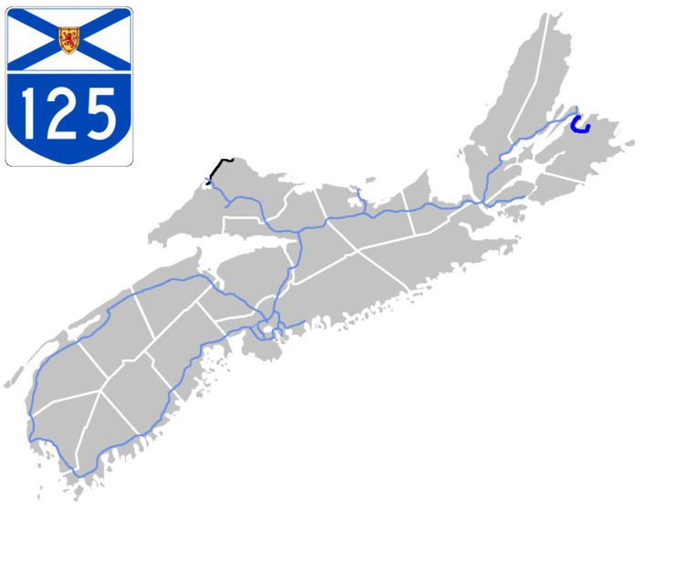
Highway 125 is a 28 km long controlled-access highway located in Nova Scotia's Cape Breton Regional Municipality. The provincial government named it Peacekeepers Way on August 18, 2008.
Contents
- Map of NS 125 Cape Breton NS Canada
- Route description
- History
- Kilometres northwest to southeast
- Interchanges from northwest to southeast
- References
Map of NS-125, Cape Breton, NS, Canada
Part of the provincial 100-series arterial highway network, Highway 125 encircles the west side of Sydney Harbour, from an interchange with Highway 105 (the Trans-Canada Highway) at Sydney Mines to Trunk 4 (Grand Lake Road) immediately east of Sydney.
Route description
The northern third of the highway was upgraded during the late 1990s and early 2000s from a two-lane freeway to a twinned 4-lane freeway. Particularly problematic was the fact that the highway passes in proximity to Pottle Lake, the water supply reservoir for North Sydney, which required installation of pollution control monitoring and containment systems.
Approximately 6 km of the highway near its midpoint is currently slated for similar upgrading. As well, the province is completing the planning and design for the twinning of the remaining two-lane section of the highway, between Exit 6 (with Trunk 4/Kings' Rd) and Exit 9 (also with Trunk 4/Grand Lake Rd).
In 2002 a connector road was built from the Grand Lake Road interchange which gives access to the port of Sydney at the former Sydney Steel Corporation property which is now an industrial park.
In the fall of 2006, an additional interchange was opened at Coxheath Road, offering direct access to the communities of Coxheath, Blacketts Lake, and the Cantley Village subdivision.
In January 2008, a public meeting was held to discuss the required infrastructure to finally twin Highway 125 from its six lane divided portion in Sydney River to its eastern terminus at Grand Lake Road. The design work and implementation will require the construction of a roundabout at the George Street exit (in addition to the roundabout at the Alexandra Street exit that was completed in December 2009), as well as over-pass structures for George Street, and Cow Bay Road/Upper Prince Street. The Cow Bay Road/Upper Prince Street overpass has now been cancelled, and a round-a-about is being proposed for Exit 9. At-grade intersections will be eliminated, and access roads will be constructed for a DND small arms range between Exits 8 (George Street) and Exit 9 (Grand Lake Road/SPAR), as well as the fresh water reservoir. The project is expected to be completed in 2012.
On December 4, 2010, twinning was completed from Exit 4 near Balls Creek to Exit 5A near Coxheath.
History
The highway was built in the late 1950s - early 1960s and extended from North Sydney to Point Edward, but branched off in Point Edward and continued along Nova Scotia Route 305 then Trunk 5 until Sydney River. When Highway 125 bypassed the Trunk 5 sections of 125 in the late 1960s - early 1970s it became a controlled access highway for a lot of the highway. In 1970 the highway extended to Grand Lake Road bypassing Sydney to Nova Scotia Trunk 4. In the 1990s the highway became twinned from Balls Creek - Upper North Sydney and from the late 1990s- early 2000s it was twinned around North Sydney and waterlines were placed around Pottle Lake. In 2010 the highway was twinned from Point Edward to Sydney River. In 2014 and 2015 the highway was twinned between Sydney River and Grand Lake Road (its eastern terminus).
Kilometres northwest to southeast
0 to 2.7 km
2.7 km to 9 km
9 km to 11.6 km
11.6 km to 19.2 km
19.2 to 28.0 km