
Airport type Public 10/28 3,995 Elevation 15 m | Owner Town of Norwood Elevation AMSL 49 ft / 15 m Code OWD Phone +1 781-255-5615 | |
 | ||
Address 125 Access Rd, Norwood, MA 02062, USA Similar Boston Logan Internatio, Mansfield Municipal ARPRT‑1, Horizon Aviation - Inc, Gillette Stadium, East Coast Aero Club - Inc | ||
Cessna 150g gopro landing norwood memorial airport kowd
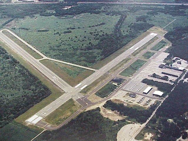
Norwood Memorial Airport (IATA: OWD, ICAO: KOWD, FAA LID: OWD) is a public-use airport located two miles (3 km) east of the central business district of Norwood, a town in Norfolk County, Massachusetts, United States. This airport is owned by the Town of Norwood. Located off Route 128, it is home to the offices of prominent local businessmen and several maintenance facilities. It was formerly Outlying Landing Field Norwood, used to train pilots from 1942 to 1945 for World War II.
Contents
Falcon 10 departure from norwood memorial airport kowd
Facilities and aircraft
Norwood Memorial Airport covers an area of 688 acres (278 ha) and has two runways:
For the 12-month period ending January 1, 2006, the airport had 100,000 aircraft operations, an average of 273 per day: 77% general aviation, 22% air taxi and 1% military.
There are 246 aircraft based at this airport: 81% single engine, 12% multi-engine, 4% jet aircraft and 2% helicopters.
The airport also includes two flight schools and Flight Level Aviation as an FBO. Charter services operate commonly out of the airport.
As a result of federal budget cuts, the air traffic control tower was to be closed in 2013, but FAA funding was restored before closure took place, enabling continued operation.
Incidents
On June 4, 2007 a Mooney M-20-P crashed into the woods south of the airport while on final approach. One person was killed.
In March 2010, the airport was closed due to severe flooding.