
Population 620 (2011) Civil parish Norton in Hales Local time Sunday 10:42 PM | OS grid reference SJ702386 Dialling code 01630 | |
 | ||
Weather 10°C, Wind SW at 21 km/h, 94% Humidity | ||
Norton in Hales is a village and parish in Shropshire, England.
Map of Norton in Hales, UK
It lies on the A53 between the town of Market Drayton and Woore, Shropshire's most northeasterly village and parish.
Staffordshire is to the east of the parish and Cheshire to the west. Also within the parish is the village of Betton and hamlet of Ridgwardine.
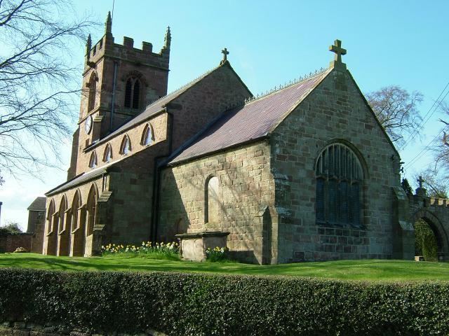
Within the village is Norton in Hales Church of England Primary School, Saint Chad's Church, The Hinds Head Inn, and a large playing field.
Tunstall Hall is a Grade II* listed building, built in about 1732, formerly a girls school, is now a residential home offering specialist care in dementia.
References
Norton in Hales Wikipedia(Text) CC BY-SA