Population 118 (in 2011) Civil parish Norton Post town Malmesbury | OS grid reference ST886844 Unitary authority Dialling code 01666 | |
 | ||
Norton is a small village and civil parish in Wiltshire, England, about 3.5 miles (5.6 km) southwest of Malmesbury. The parish includes the hamlets of Foxley and Bremilham (also known as Cowage).
Contents
Map of Norton, Malmesbury, UK
The Sherston branch of the Bristol Avon forms the north boundary of the parish.
History
Bronze age ring ditches and signs of early medieval or Saxon settlement are in the east of the parish, near Cowage Farm.
The Fosse Way Roman road forms the west boundary of the parish, where it is a bridleway.
The east-west road between Malmesbury and Sherston passes through Foxley and Bremilham. From the late 17th century until 1756 this was the main route between Oxford and Bristol.
Foxley and Bremilham were separate ecclesiastical parishes until 1893 when Bremilham was united with Foxley. In 1934 Foxley (with Bremilham) was transferred to the civil parish of Norton.
Churches
The Anglican Church of All Saints at Norton is Grade II listed. It probably dates from the 13th century and was restored in the 19th century.
The undedicated church at Foxley may also originate in the 13th century and is Grade I listed.
The small church at Cowage Farm, Bremilham is the remainder of a 15th-century church.
Manor houses
Two manor houses follow:
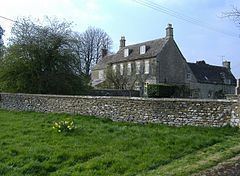
Norton Manor is from the early 17th century and is Grade II* listed.
Foxley Manor is from a similar date and is Grade II listed. (Not to be confused with Foxley House, next to the church and also Grade II listed).
Local government
There is no elected parish council, instead an annual Parish meeting is held. The parish is in the area of Wiltshire Council unitary authority, which is responsible for all significant local government functions.
Amenities
Norton has a pub and restaurant, the Vine Tree.
