
Population 439 Civil parish Norton Dialling code 01684 | OS grid reference SO856241 Sovereign state United Kingdom | |
 | ||
Norton is a civil parish in the English county of Gloucestershire.
Contents
Map of Norton, Gloucester, UK
Overview
The main settlements in the parish are the three hamlets of Norton (sometimes called Cold Elm Norton), Bishop's Norton and Prior's Norton.
The parish is bisected by the main A38 road that connects Gloucester and Tewkesbury, Bishop's Norton lying to its west and Prior's Norton to its east. Norton formerly lay on the road but is now bypassed. For the purposes of local government the parish forms part of the Tewkesbury (borough)
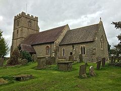
The village has a small school (Norton Church of England Primary School), a village hall, a sports pitch, a pub (The Red Lion at Wainlode Hill) and a church. ^
The parish of Norton had a population of 439 according to the 2011 census.
Governance
Norton falls in 'Coombe Hill' electoral ward. This ward stretches from Deerhurst in the north to the edge of Gloucester. The total ward population taken at the 2011 census was 4,545.