Country India Headquarters Kanjhawala Lok Sabha constituency North-West Delhi Elevation 213 m | State Delhi Time zone IST (UTC+5:30) Area 442.8 km² | |
 | ||
Civic agency North Delhi Municipal Corporation Government body Municipal Corporation of Delhi Points of interest Adventure Island, Jain temple, Centre Market Dc Chowk Tr, Japanese Park, Sheesh Mahal Colleges and Universities Maharaja Agrasen Institute o, Satyawati College, Sri Guru Gobind Singh Col, Jagan Institute of Manage, Vivekananda Institute of Professio | ||
North West Delhi is an administrative district of the National Capital Territory of Delhi in India.
Contents
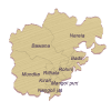
Map of North West Delhi, Delhi
Geography
North West Delhi is bounded by the Yamuna River on the northeast, and by the districts of North Delhi to the east and southeast, West Delhi to the south, Jhajjar District of Haryana state to the west, Sonipat District of Haryana to the northwest and north, Bagpat District and Ghaziabad District of Uttar Pradesh state to the northeast across the Yamuna.
Demographics
According to the 2011 census North West Delhi has a population of 3,651,261, roughly equal to the nation of Liberia or the US state of Oklahoma. This gives it a ranking of 78th in India (out of a total of 640). The district has a population density of 8,298 inhabitants per square kilometre (21,490/sq mi) . Its population growth rate over the decade 2001-2011 was 27.63%. North West Delhi has a sex ratio of 862 females for every 1000 males, and a literacy rate of 84.66%.
Administration
Administratively, the district is divided into three subdivisions, Saraswati Vihar, Narela, and Model Town.
