
Population 5,097 (2011 census) Postal code 4810 | Postcode(s) 4810 | |
 | ||
Location 1.9 km (1 mi) NW of Townsville City347 km (216 mi) S of Cairns1,355 km (842 mi) NNW of Brisbane | ||
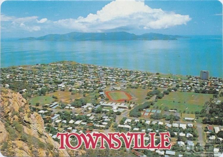
North Ward is a suburb in Townsville, Queensland, Australia.
Contents
- Map of North Ward QLD 4810 Australia
- Geography
- History
- Heritage listings
- Amenities in North Ward
- References
Map of North Ward QLD 4810, Australia
Geography
North Ward is home to the beachside area known as The Strand, which overlooks Magnetic Island. The land is mostly flat at close to sea level except for Stanton Hill in the south of the locality (19.2551°S 146.8135°E / -19.2551; 146.8135 (Stanton Hill)) which rises to 60 metres. Kissing Point is a headland at the most northerly part of North Ward.
History
North Ward is among Townsville's oldest suburbs, dating to the 1870s.
Heritage listings
North Ward has a number of heritage-listed sites, including:
Amenities in North Ward
Parks:
Sport:
Schools:
References
North Ward, Queensland Wikipedia(Text) CC BY-SA