
Population 1,317 Civil parish North Duffield Sovereign state United Kingdom Local time Friday 4:19 PM | OS grid reference SE684369 | |
 | ||
Weather 18°C, Wind SW at 31 km/h, 46% Humidity | ||
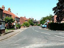
North Duffield is a village and civil parish in the Selby District of North Yorkshire, England. It lies about 7 km north-east of Selby on the A163 road from Selby to Market Weighton. The River Derwent forms the eastern boundary of the parish.
Contents
Map of North Duffield, Selby, UK
It has an area of around 4081 hectares (according to 2001 UK Census data [1]). There are approximately 1800 residents in the village, the majority of whom are aged between 30 and 50 years. The population at the 2011 Census was 1,317.
North Duffield is home to a Community Primary School, Methodist Church, village hall, village green, hairdressers, garage, the black cat rescue, park, shop, pub, Duck pond, lots of fields, and a bowls club.
There is an active North Duffield Conservation and local History Society, whose web site can be found at www.ndchs.org.uk, which is currently funded by Lottery Funding.
North Duffield has its own village football team, North Duffield Dragons, for children aged between 3 and 16. Their website is located at www.northduffielddragonsjfc.co.uk
Menthorpe Gate railway station on the Selby to Driffield Line served the village from 1853 to 1953.
Governance
An electoral ward in the same name exists. This ward stretches North East to Thorganby with a total population taken at the 2011 Census of 1,913.