
Existed: before 1940 – present Length 197.3 km | East end: ND 41 near Velva | |
 | ||
West end: US 85 / ND 200 near Watford City Counties McKenzie County, North Dakota | ||
North Dakota Highway 23 (ND 23) is an east–west highway in northwestern North Dakota. The highway runs 123 miles (198 km) between its eastern terminus at ND 41 near Velva, and its western terminus at US 85 in Watford City.
Contents
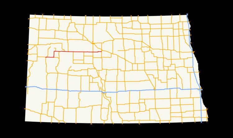
Map of ND-23, North Dakota, USA
The only cities that ND 23 runs directly through are New Town and Watford City. It also runs through the unincorporated community of Keene. Other cities near the route include Makoti, Parshall, Plaza, Ryder, and Velva. Minot is 16 miles (26 km) north of the highway at its intersection with US 83.
Route description
North Dakota Highway 23 has its western terminus at a junction with US 85 and ND 200 in Watford City. The route runs north for less than a mile, then east outside of the city limits. After leaving Watford City, the route intersects with the first section of ND 1806, to which it serves as the southern terminus. The route then turns due north for about six miles at an intersection with ND 73. ND 23 then runs north through the small community of Keene. After turning eastward once more, the route shares another intersection with ND 1806 serving as the southern terminus of its second section. ND 23 intersects with ND 22 before leaving McKenzie County and entering Mountrail County by crossing Lake Sakakawea on the Four Bears Bridge.
Just after entering Mountrail County, ND 23 has a junction with ND 1804 in New Town. This is the western end of a concurrency with ND 1804 in which ND 1804 is unsigned. Heading eastward seven more miles, the route serves as the southern terminus of ND 8. Just north of Parshall the route serves as the northern terminus of ND 37. This junction is also the eastern end of the route's concurrency with ND 1804. The route then runs three miles south of Plaza before entering Ward County.
Two miles east of the county line, ND 23 runs just north of Makoti. The highway then serves as the northern terminus of ND 28, a short route that connects ND 23 to the small city of Ryder. Ten miles north of Max and sixteen miles south of Minot, ND 23 intersects US 83 before entering McHenry County. In McHenry County the highway travels east for about fifteen miles before meeting its eastern terminus south of Velva at ND 41.