
Existed: 1958 – present Counties: Columbus Constructed 1958 | South end: SC 905 at the SC line Length 33.6 km | |
 | ||
North end: NC 130 in Pleasant Plains County | ||
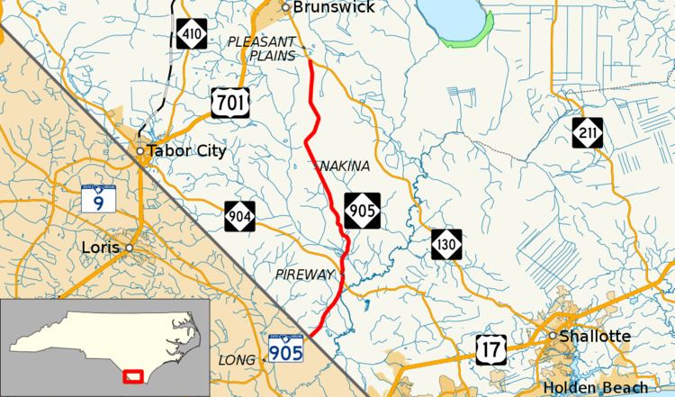
North Carolina Highway 905 (NC 905) is a primary state highway in the state of North Carolina. It serves as part of an alternate route between Whiteville and Conway, South Carolina, through southeastern Columbus County.
Contents
Map of NC-905, North Carolina, USA
Route description
NC 905 is a two-lane rural highway that begins at the South Carolina line and South Carolina Highway 905 (SC 905) in Olyphic. Traveling north, it connects with NC 904 in Pireway. After its six-tenths-mile (0.97 km) concurrency with NC 904, it continues solo for 15.1 miles (24.3 km), connecting the communities of Bug Hill and Nakina, until it ends at NC 130 in Pleasant Plains.
The route is part of a larger alternate route to U.S. Route 701 between Whiteville, North Carolina and Conway, South Carolina via NC 130 and SC 905. From 1958 to 2016, it was the highest number signed as a primary route in North Carolina.
History
NC 905 was established around 1958 as an extension of SC 905, which had ended at the state line since around 1942. Its route from Olyphic to Pleasant Plains has remained unchanged since.
Junction list
The entire route is in Columbus County.