
Existed: 1930 – present Length 20.6 km | Counties: Stanly Constructed 1931 | |
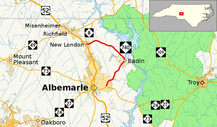 | ||
South end: NC 24 / NC 27 / NC 73 in Albemarle North end: US 52 / NC 8 in New London County | ||
North Carolina Highway 740 is a primary state highway in the U.S. state of North Carolina. The main purpose of highway is to connect the town of Badin with the rest of Stanly County.
Contents
Map of NC-740, North Carolina, USA
Route description
NC 740 is a two-lane rural highway; starting in Albemarle, it goes northeast to the factory town of Badin. NC 740 through Badin is decorated with many town banners and street lights; most of the stoplights are found on the street corners rather than suspended from overhead wires. After it goes through the town, NC 740 skirts along the banks of Badin Lake before going northwest to New London, where it ends.
History
Established around 1930 as a spur of NC 74 (renumbered NC 73 in 1934), it connected Albemarle to the town of Badin then back to New London, ending at NC 80 (current NC 8). In 1933, it was extended north, replacing some of NC 62; but then reverted to original terminus in 1935, replaced by NC 62A and later NC 8. In the mid-1950s, NC 740 moved south from Badin Road to a new terminus with NC 27. In the early 1980s, NC 740 was overlapped with NC 8 and extended .2 miles (0.32 km) to its current northern terminus.
Junction list
The entire route is in Stanly County.