
Existed: 1961 – present Length 13.4 km | Counties: Moore Constructed 1961 | |
 | ||
County | ||
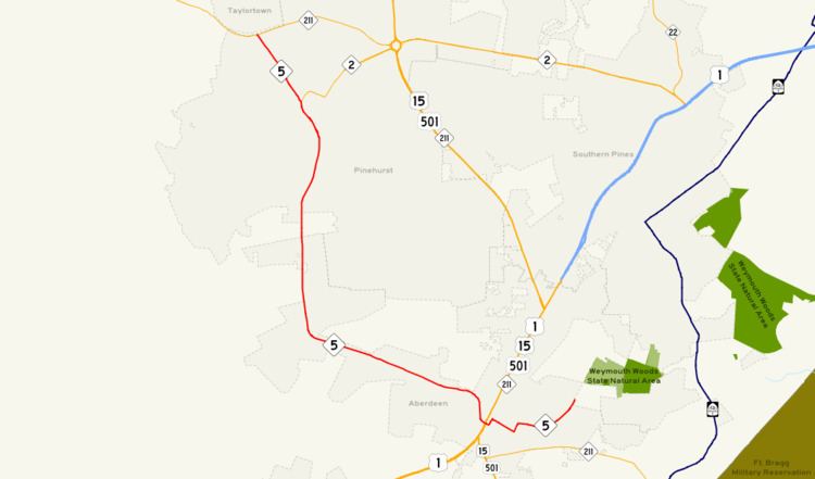
North Carolina Highway 5 (NC 5) is a six-mile (10 km) North Carolina state highway. It runs entirely within Moore County and connects the Sandhills municipalities of Aberdeen and Pinehurst. It also serves as an alternate route for NC 211. NC 5's route was designated in 1961 and it has not changed since then.
Contents
- Map of NC 5 North Carolina USA
- Route description
- Nearby points of interest
- Major intersections
- References
Map of NC-5, North Carolina, USA
Route description
NC 5 starts at a three-way intersection at Malcolm Blue Farm and progresses through downtown Aberdeen, where it crosses U.S. 1/US 15/US 501/NC 211/Sandhills Boulevard and continues northwest towards Pinehurst. It comes to its northern terminus at NC 211 at the Pinehurst/Taylortown city limits border.
All the NC 5 shields east of Sandhills Boulevard have no directional plates; this is because at NC 5's southern terminus, the route is heading in a northerly direction.
NC 5's central segment parallels a railroad owned by Norfolk Southern. Sand Pit Road between Aberdeen and Pinehurst splits from NC 5 and heads due south to the nearby town of Pinebluff.
Nearby points of interest
Major intersections
The entire route is in Moore County.