
Existed: 1985 – present Counties: Dare Constructed 1985 | Length 1.01 km | |
 | ||
County | ||
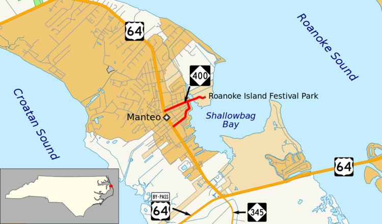
North Carolina Highway 400 (NC 400) is the shortest primary state highway in North Carolina. It is 0.63 miles (1.01 km) long and is entirely within the town of Manteo, North Carolina on Roanoke Island. The route traverses from its western terminus at U.S. Route 64 to the Elizabeth II vessel (State Historic Site) docked on Ice Plant Island, located in Shallowbag Bay. Unlike other state routes, all of the NC 400 markers have brown recreational backgrounds. The route is split among two one-way streets: eastbound and westbound.
Contents
Map of NC-400, Manteo, NC 27954, USA
Route description
NC 400 begins at an intersection with U.S. Route 64 in the community of Manteo, North Carolina. The route begins as a pair of one-way street, with NC 400 heading eastbound along Fernando Street and westbound along Ananias Dare Street. The eastbound direction heads through a residential portion of Manteo, running along Fernando Street, turning northward at an intersection with Queen Elizabeth Street, where it heads to Ananias Dare Street, meeting with the westbound alignment of NC-400. There, the now two-way street heads eastward as Festival Park, crossing Dough's Creek and entering the Roanoke Waterfront, where the Elizabeth II, a ship declared historic by the state of North Carolina, is docked. This also serves as the eastern terminus of NC 400.
Major intersections
The entire route is in Manteo, Dare County.