
Existed: 1935 – present Length 40.9 km | Constructed 1935 | |
 | ||
Counties | ||
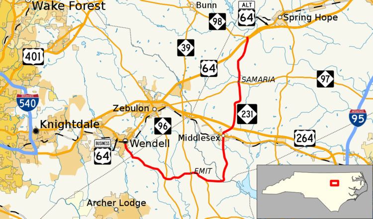
North Carolina Highway 231 (NC 231) is a primary state highway in the U.S. state of North Carolina. The highway serves to connect communities in northern Johnston and western Nash counties.
Contents
Map of NC-231, North Carolina, USA
Route description
NC 231 is a two-lane rural highway that traverses 25.4 miles (40.9 km) from Wendell to near Spring Hope; making a "J" shape on a map through Hocutts Crossroads. With Wendell and Middlesex as the two main cities along its route, the highway passes through predominantly forest and farmland, with the occasional unincorporated community.
History
The first NC 231 was established in 1925 as a new primary routing from NC 21/NC 23 in Elizabethtown to NC 20 in Acme. By 1928, it was renumbered as part of NC 21 (today's NC 87).
The current NC 231 was established in 1935 as a new primary routing from NC 39 to US 64. In 1948, NC 231 was extended west to US 64 in Wendell. In 1975, NC 231 was shifted west to its current northern terminus to accommodate the US 64 freeway; its old alignment became part of Jernigan and Cox roads.