
Existed: 1931 – present Constructed 1931 | Length 313.8 km | |
 | ||
Counties Johnston County, North Carolina | ||
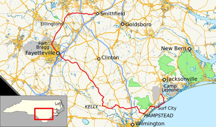
North Carolina Highway 210 (NC 210) is a 195-mile-long (314 km) North Carolina state highway that connects settlements in the Atlantic Coastal Plain region. Due to its meandering route NC 210 changes directional orientation three times, changing from east-west to north-south near Angier, changing from north-south to west-east near Moores Creek National Battlefield, and reversing west-east directions on Topsail Island. The route traverses through central Fayetteville and the Fort Bragg Army installation and crosses both Topsail Island access bridges over the Atlantic Intracoastal Waterway.
Map of NC-210, North Carolina, USA
References
North Carolina Highway 210 Wikipedia(Text) CC BY-SA