
Country United States County Harnett FIPS code 37-01400 Area 6 km² Zip code 27501 Population 4,718 (2013) | State North Carolina Time zone EST (UTC-5) GNIS feature ID 0980193 Elevation 89 m Local time Saturday 5:50 AM Area code 919 | |
 | ||
Weather 12°C, Wind W at 3 km/h, 100% Humidity | ||
Angier is a town in the Black River Township of Harnett County, North Carolina, United States. The population was 4,350 at the 2010 census. Angier is a part of the Dunn Micropolitan Area, which is also a part of the greater Raleigh–Durham–Cary Combined Statistical Area (CSA) as defined by the United States Census Bureau.
Contents
- Map of Angier NC 27501 USA
- 272 golden oats drive angier north carolina 27501 mls 467022
- History
- Geography
- Demographics
- Education
- Culture
- Notable person
- References
Map of Angier, NC 27501, USA
272 golden oats drive angier north carolina 27501 mls 467022
History
The Williams Grove School was listed on the National Register of Historic Places in 1995.
Geography
Angier is located at 35° 30’31" North, 78° 44’15" West (35.508587, -78.737487).
According to the United States Census Bureau, the town has a total area of 2.3 square miles (6.0 km2), of which, 2.3 square miles (6.0 km2) of it is land and 0.43% is water.
Demographics
As of the census of 2000, there were 3,419 people, 1,356 households, and 870 families residing in the town. The population density was 1,493.7 people per square mile (576.5/km²). There were 1,478 housing units at an average density of 645.7 per square mile (249.2/km²). The racial makeup of the town was 67.42% White, 23.37% African American, 0.41% Native American, 0.94% Asian, 0.03% Pacific Islander, 6.23% from other races, and 1.61% from two or more races. Hispanic or Latino of any race were 12.17% of the population.
There were 1,356 households out of which 31.8% had children under the age of 18 living with them, 43.2% were married couples living together, 16.7% had a female householder with no husband present, and 35.8% were non-families. 28.3% of all households were made up of individuals and 10.0% had someone living alone who was 65 years of age or older. The average household size was 2.46 and the average family size was 3.00.
In the town, the population was spread out with 25.4% under the age of 18, 10.3% from 18 to 24, 32.5% from 25 to 44, 20.0% from 45 to 64, and 11.8% who were 65 years of age or older. The median age was 33 years. For every 100 females there were 92.1 males. For every 100 females age 18 and over, there were 89.0 males.
The median income for a household in the town was $33,849, and the median income for a family was $43,784. Males had a median income of $30,215 versus $26,028 for females. The per capita income for the town was $15,985. About 10.6% of families and 16.3% of the population were below the poverty line, including 14.4% of those under age 18 and 30.4% of those age 65 or over.
Education
Culture
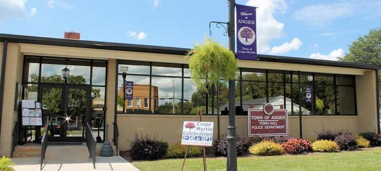
Angier annually hosts a town festival called the "Crepe Myrtle Festival," which attracts approximately 20,000 visitors. The town also calls itself "The Town of Crepe Myrtles." Each summer Angier draws a crowd of motorcyclists and bike enthusiasts from across the region to downtown Angier to enjoy the sights, sounds and tastes of its annual Bike Fest event. The family-friendly event features live music, a bike show, a poker-run fund-raiser, exhibits and fun for people of all ages.
Angier lies along the distinctly cultural "Art Road and Farm Trail" through Bladen, Cumberland, Harnett, Johnston and Robeson Counties.