
Existed: 1952 – present Length 6.9 km | Counties: Cleveland Constructed 1952 | |
 | ||
County | ||
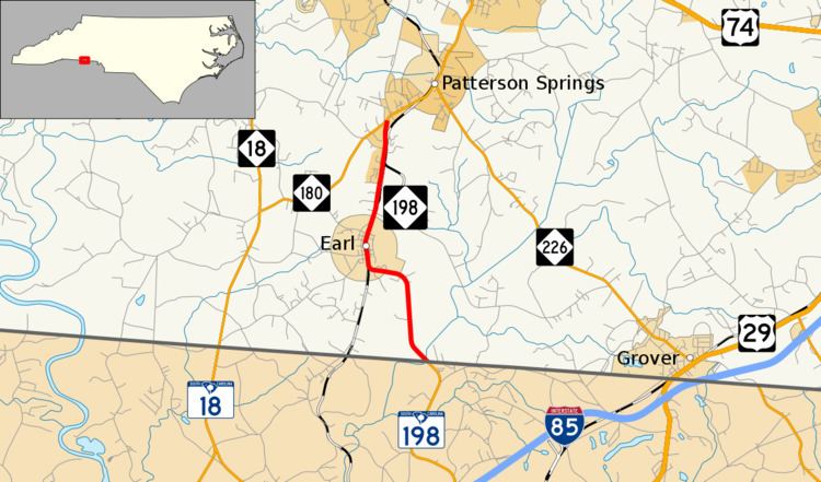
North Carolina Highway 198 is a primary state highway in the U.S. state of North Carolina. It connects the town of Earl with the rest of Cleveland County.
Contents
Map of NC-198, Grover, NC 28073, USA
Route description
A two-lane rural highway, it traverses 4.3 miles (6.9 km), starting at the South Carolina state line at Buffalo Creek, through the town of Earl, ending at NC 180, south of Patterson Springs.
History
Established in 1952, the route has not changed since.
Junction list
The entire route is in Cleveland County.
References
North Carolina Highway 198 Wikipedia(Text) CC BY-SA